Forge: Editing map parameters.
- Getting started
Training
Editing a map's parameters in Forge allows you to adjust elements that are essential to structuring, visualizing, and using. These parameters directly influence The Browsing Experience, the Legibility of the floors, as well as the Visual customization via styles.
This chapter outlines the tools and actions available to:
- Manage Viewpoints of the default camera.
- Add or remove Floors in progress.
- Integrate and configure Basemaps reference point.
- Change the display order of the layers.
- Define or modify Graphic styles associated with the card.
These features are essential to the Preparation of a structured cartographic environment, facilitating both the modeling and the future exploitation of the card in the other modules of the Immersive suite.
Prerequisites
- Have Forge installed
- Have launched Forge connected to the target organization where the card will be stored.
- Have knowledge of the Forge interface and the role of its different parts.
- Have created and posted a map.
Point of view
A default viewpoint is created when the map is created. This is a pre-set position of the camera, which will be used when the map is opened.
By default, it is positioned vertically from the center of the map.
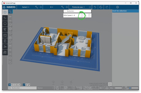
To change it, you have to position the camera in the desired angle, then from the Viewpoints menu, click on the floppy disk to save the new viewpoint.
Floors
It is possible to add and remove floors outside of the map builder.
Add a floor
To add a floor, tap the + and fill in the name of the floor.
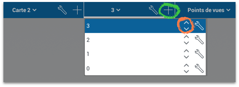
To change its position in the list, use the arrows at the end of the line.
Delete a floor
To remove a floor, it must first be emptied of all its contents. If the floor is not empty, the interface will indicate that it cannot be deleted.
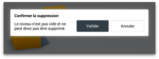
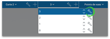
Once empty, you have to click on the wrench of the corresponding floor to select it, then press the "Delete" key and confirm.